1/5

UHF Radio Transceiver WiFi Avaliable V90 Plus Gnss Rtk System
$3.00 / Set
- FOB Price:
- Negotiable | Get Latest Price
- Order Quantity:
- 1 Set / Sets
- Supply Ability:
- 1000 Set / Sets per Month
- Port:
- shanghai
- Payment Terms:
- T/T L/C D/P D/A Credit Card PayPal Cash Escrow Other
- Delivery Detail:
- 5 days
Hot in store
-
Borehole Geophone Land Geophones Seismi
$1.00 -
Geophysical Well Logs Aquifer Mapping We
$1.00 -
Masw/Refraction/Reflection/Borehole Surv
$1.00 -
Geophone Sensors Mems Geophone Geophone
Inquiry -
Digital Incinometer Borehole Inclinomet
$1.00 -
Borehole Deviation Tester Wireless Incl
$1.00 -
Jqx-2 Best Selling Digital Inclinometer
$1.00 -
Portable Digital Inclinometer for Drilli
$1.00
Product Details
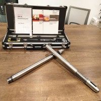
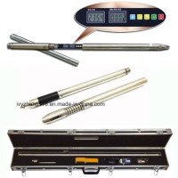
Product Name: UHF Radio Transceiver WiFi Avaliable V90 Plus Gnss Rtk System Model NO.: V90 Plus GNSS RTK System Warranty: 1 Year Certification: CE, FCC Port Number: Multichannel Carrier Frequency: Dual-Frequency Operating Principle: Code Related Type Condition: New Operation System: Linux 3.2 Appliccation: Geodetic Surveying & Mapping GPS: Support Glonass: Support Bds: Support Galileo: Support Other Satellites: Sbas, Qzss Channel: 220 Waterproof: IP67 Trademark: Hi-Target Transport Package: Standard Export Package with Carton Case Origin: China HS Code: 9015800090 Product Description Hi-Target UHF Radio Transceiver WIFI avaliable V90 Plus GNSS RTK SystemV90 is a new type of GNSS RTK GPS system used for measurement pushed forward by Hi-Target recently. With a hi-tech, fully integrated design, the conveniently sized V90 is one of the most flexible choices for any measuring task. Built-in Linux3.2.0 operating system, pre-loaded multiple smart applications such as tilt surveying, electronic bubble calibration, NFC and voice DIY, LEDs enable you to monitor satellite tracking, radio reception, data logging status, Wi-Fi status, and power. Bluetooth wireless technology provides cable-free communications between the receiver and controller.V90 GNSS system provides surveyor industry-leading GNSS solutions.Technical Parameters of the V90 Plus GNSS RTK System:Satellite Signals Tracked Simultaneously220 ChannelsGPS...….. Simultaneous L1C/A, L2C, L2E, L5GLONASS......…..Simultaneous L1C/A, L1P, L2C/A (GLonASS M only), L2PSBAS............. Simultaneous L1 C/A, L5Galileo............ Simultaneous L1 BOC, E5A, E5B, E5AltBOCBDS..............................…. B1, B2QZSS.............. L1 C/A, L1 SAIF, L2C, L5Static and Fast Static GNSS SurveyingHorizontal............2.5mm+0.5ppm RMSVertical................ 5mm+0.5ppm RMSPost Processing Kinematic(PPK / Stop & Go) GNSS SurveyingHorizontal............….. 1cm+1ppm RMSVertical............... 2.5cm+1ppm RMSInitialization time...….Typically 10 minutes for base while 5 minutes for roverInitialization reliability...Typically > 99.9%Real Time Kinematic (RTK) SurveyingSingle baselineHorizontal............….. 8mm+1ppm RMSVertical................ 15mm+1ppm RMS Network RTKHorizontal............….. 8mm+0.5ppm RMSVertical................. 15mm+0.5ppm RMSInitialization time.....…Typically < 8secondsInitialization reliability....Typically > 99.9%Code Differential GNSS PositioningHorizontal............…. 25cm+1ppm RMSVertical...............… 50cm+1ppm RMSSBAS ...… 0.50m Horizontal, 0.85m VerticalHardwarePhysicalDimensions (W x H)....153mm x 83mm (6.02inch x 3.27inch)Weight...…950g (2.09lb) without internal batteryOperating temperature...…. -40ºCto +65ºC (-40ºF to +149ºF)Storage temperature....... -40ºC to +75ºC(-40ºF to +167ºF)Humidity............…. 100%, consideringWater/dustproof........... IP67 dustproof, protected from temporary immersion to depth of 1m (3.28ft).Shock and vibration......…Designed to survive a 3m(9.84ft) natural fall onto concrete.ElectricalPower 6V to 28V DC external power inputPower consumption ≤3.5WAutomatic switching between internal power and external powerRechargeable, removable 7.4V, 5000mAh Lithium-ion battery in internal battery compartmentInternal Battery LifeStatic 12hoursRTK rover (UHF/GPRS/3G) 8-10 hoursRTK base 8 hoursContact US:
Contact with Supplier
Recommend product
-
Stripped Soft Goose Fe
$3.00 -
plastic ball grinding
$30000.00 -
CAT piston pump 281
$4000.00 -

Droichead Zirconia Plu
$10.00 -

E.max crown, Veneer, I
Inquiry -
ReSiC Beams/plates/bur
$16.00 -
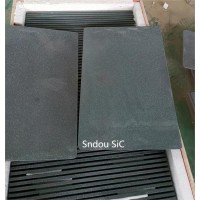
RSiC Slabs Boards Tile
$15.00 -
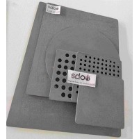
RSiC Batts as Kiln she
$15.00 -

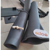
RSiC Tube by recrystal
$10.00 -
RSiC Kiln Furniture (B
$16.00 -
RSiC Burner Nozzle Fla
$18.00 -
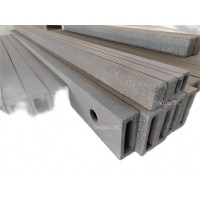
RSiC Beam Support Pill
$16.00 -
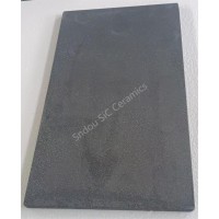
RSiC plate Slab Board
$15.00 -

NSiC Tube Pipes by Nit
Inquiry -
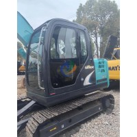
used excavator hudraul
$16600.00 -
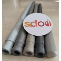
NSiC Thermocouple Prot
Inquiry -

Stalk Riser Tube for L
Inquiry -
NSiC Ceramic Heater Pr
Inquiry -

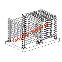
RSiC NSiC Ceramic Kiln
Inquiry -

used excavator hudraul
$11500.00
Product parameters
closure
This shop is operated by agent
- Set up shop
- Authorized by Manufacturers & Suppliers online marketplace B2B platform GongWong.com, can provide agency service
- Service Introduction
- Authorized product, Internet cloud promotion service integrating certification promotion and procurement inquiry
- Intelligent website construction
- PC terminal + mobile terminal, create a cost-effective corporate website!
closure