1/5

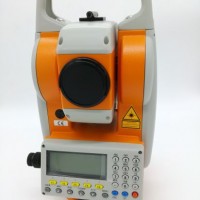
Small and Lightweight Hi-Target V90 GPS Gnss Rtk
$7.00 / Piece
- FOB Price:
- Negotiable | Get Latest Price
- Order Quantity:
- 1 Set / Sets
- Supply Ability:
- 1000 Set / Sets per Month
- Port:
- shanghai
- Payment Terms:
- T/T L/C D/P D/A Credit Card PayPal Cash Escrow Other
- Delivery Detail:
- 5 days
Hot in store
-
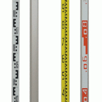
Tc-1 Telescopic Leveling Staff 5meter St
$12.00 -

High Quality New Galaxyz Gal32 Auto Leve
Inquiry -
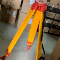
Hot Sell Wooden Tripod for Total Station
Inquiry -

Prism Pole 2.15m 2.5m 3m 3.6m 4.6m
$50.00 -
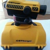
Cst Berger 32X Auto Level
$80.00 -
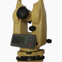
New High Quality Theodolite Galaxyz Get2
$390.00 -
Hot Sell Mato Mts602L Reflectorless Tota
$1.00 -
T3 Gnss Receiver 576 Channels China Bran
$4.00
Product Details
Product Name: Small and Lightweight Hi-Target V90 GPS Gnss Rtk Model NO.: V90 Channel: 220 Channels Trademark: Hi-target Transport Package: Original Origin: China HS Code: 9015800090 Product Description Contact usShanghai Galaxy International Trade CO.,LtdADD: Rm.306-308,No.5 Building,Jinglian Road 439#,Minhang District,Shanghai,ChinaFAX: +86-21-51685021TELL: +86-21-64396577Controller Performance SpecificationsiHand20system configurationOS:Android 4.2Processor:MT6589,1.5GHz,4coreRAM:1GBFlash memory:4GBCommunication interfaceBluetoothNFCMini USBWIFI:802.11b/gMicroSD card slot,support up to 32GBDual Sim Dual Standby,support 2G and 3GPower supply3.7V,6300mAh lithium battery,up to 25 hourscontinuous operationPhysical propertiesIntergrated keyboardSize:213mm×89mm×35mmWeight:520g(with battery)Operating temperature:-20ºC+55ºCStorage temperature:-30ºC+65ºCWater/dustproof:IP68Anti-shock:1.2m natural fallV90 PERFORMANCE SPECIFICATIonSStatellite Signals Tracked SimultaneouslyChannel220 ChannelsGPSSimultaneous L1C/A, L2C, L2E, L5GLonASSSimultaneous L1C/A, L1P, L2C/A, (GLonASS Monly), L2PSBASSimultaneous L1C/A, L5GalileoSimultaneous L1 BOC, E5A, E5B, E5AltBOC1BDSB1, B2QZSSL1C/A, L1 SAIF, L2C, L5POSITIonING PERFORMANCE2Static and Fast Static GNSS SurveyingHorizontal2.5mm+0.5ppm RMSVertical5mm+0.5ppm RMSPost Processing Kinematic (PPK /Stop &Go )GNSS SurveyingHorizontal1mm+1ppm RMSVertical2.5mm+1ppm RMSInitialization timeTypically 10 minutes for base while 5minutes for roverInitialization reliabilitytypically >99.9%Real time Kinematic (RTK) surveyingSingle baselineHorizontal8mm+1ppm RMSVertical15mm+1ppm RMSNetwork RTKHorizontal8mm+1ppm RMSVertical15mm+1ppm RMSInitialization timetypically <8 secondsInitialization reliabilitytypically >99.9%Code Differential GNSS PositionnigHorizontal25cm+1ppm RMSVertical50cm+1ppm RMSSBAS0.50m Horizontal, 0.85m VerticalCOMMUNICATIonNetwork CommunicationFully integrated, fully sealed internal WCDMA, compatible with GPRS, GSMWifi frequency is 2.4G, supports 802.11b/g/n protocol802.11b/g/nNetwork RTK (via CORS) range20-50kmHI-TARGET Internal UHF Radio(Standard)Frequency450~470MHz with 116 channelsTransmitting power1W,2W, 5W adjustableTransmitting speed9.6Kbps, 19.2KbpsWorking range5km typical, 8~10kmoptimalHI-TARGET External UHF Radio(Standard)Frequency460MHZ with 116 channelsTransmitting power5W,10W,20W,30W adjustableTransmitting speedUp to 19.2KbpsWorking range8~10km typical,15~20km optimalHARDWAREPhysicalDimensions(W×H)153mm×83mm(6.02inch×3.27inch)Weight950g(2.09(b)without internal batteryOperating temperature-40ºC to+65ºC(-40ºF to+149ºF)Storage temperature-55ºC to+85ºC(-67ºF to+185ºF)Humidity100%,consideringWater/dustproofIP67 dustproof,protected from temporaryimmersion to depth of 1m(3.28ft)Shock and vibrationDesigned to survive a3m(9.84ft)natural fall onto concreteElectricalPower 6V to 28V DC external power inputPower consumption≤3.5WAutomatic switching between internal power and external powerRechargeable,removable 7.4V,5000mAh Lithium-ion battery in internal battery compartmentInternal Battery LifeStatic more than 10 hoursRTK rover (UHF/GPRS/3G)6-10 hoursRTK base more than 6hoursI/O InterfaceBluetooth, NFC×1standard USB2.0port×1TNC antenna connector×1RS232 serial port×1DC power input (5-pin)×1MicroSD card port×1Tilt Survey SystemElectronic BubbleSYSTEM ConFIGURATIONSYSTEMData storage16GB internal storage+Internal Micro SDCard memory (Support up to 32GB extension)Record GNS and Rinex format simultaneously
Contact with Supplier
Recommend product
-

Stripped Soft Goose Fe
$3.00 -
plastic ball grinding
$30000.00 -
CAT piston pump 281
$4000.00 -

Droichead Zirconia Plu
$10.00 -

E.max crown, Veneer, I
Inquiry -
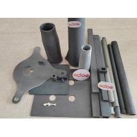
ReSiC Beams/plates/bur
$16.00 -
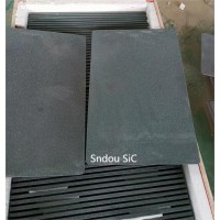
RSiC Slabs Boards Tile
$15.00 -
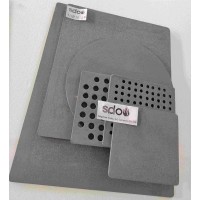
RSiC Batts as Kiln she
$15.00 -

RSiC Tube by recrystal
$10.00 -
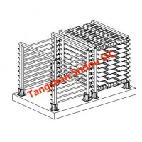
RSiC Kiln Furniture (B
$16.00 -
RSiC Burner Nozzle Fla
$18.00 -
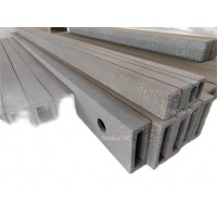
RSiC Beam Support Pill
$16.00 -
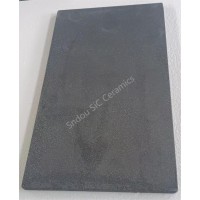
RSiC plate Slab Board
$15.00 -

NSiC Tube Pipes by Nit
Inquiry -
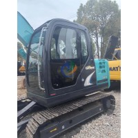
used excavator hudraul
$16600.00 -
NSiC Thermocouple Prot
Inquiry -

Stalk Riser Tube for L
Inquiry -
NSiC Ceramic Heater Pr
Inquiry -

RSiC NSiC Ceramic Kiln
Inquiry -

used excavator hudraul
$11500.00
Product parameters
closure
This shop is operated by agent
- Set up shop
- Authorized by Manufacturers & Suppliers online marketplace B2B platform GongWong.com, can provide agency service
- Service Introduction
- Authorized product, Internet cloud promotion service integrating certification promotion and procurement inquiry
- Intelligent website construction
- PC terminal + mobile terminal, create a cost-effective corporate website!
closure