1/5

Hi-Target Gnss Rtk System/Rtk GPS L1 L2/Tilt Survey GPS Receiver
$3.00 / Set
- FOB Price:
- Negotiable | Get Latest Price
- Order Quantity:
- 1 Set / Sets
- Supply Ability:
- 1000 Set / Sets per Month
- Port:
- shanghai
- Payment Terms:
- T/T L/C D/P D/A Credit Card PayPal Cash Escrow Other
- Delivery Detail:
- 5 days
Hot in store
-
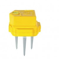
Borehole Geophone Land Geophones Seismi
$1.00 -
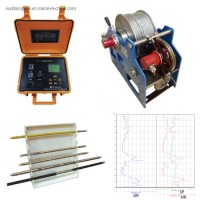
Geophysical Well Logs Aquifer Mapping We
$1.00 -
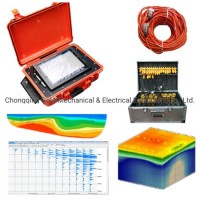
Masw/Refraction/Reflection/Borehole Surv
$1.00 -
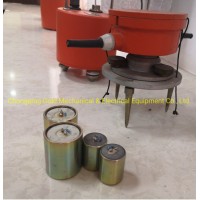
Geophone Sensors Mems Geophone Geophone
Inquiry -
Digital Incinometer Borehole Inclinomet
$1.00 -
Borehole Deviation Tester Wireless Incl
$1.00 -
Jqx-2 Best Selling Digital Inclinometer
$1.00 -
Portable Digital Inclinometer for Drilli
$1.00
Product Details
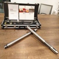
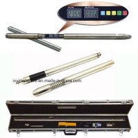
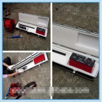
Product Name: Hi-Target Gnss Rtk System/Rtk GPS L1, L2/Tilt Survey GPS Receiver Model NO.: V90 Plus GNSS RTK System Horizontal Line: GPS Horizontal Vertical: 8mm+1ppm RMS Vertical Lines: GPS Static Vertical: 15mm+1ppm RMS Accuracy: Within Cm Level Condition: New Gnss Rtk System GPS Type: Automatic GPS Receiver Application: Geodetic Surveying and Mapping Signal Tracking: GPS, Glonass, Bds, Galileo, Qzss, Sbas Waterproof: IP67 Warranty: 12 Months Tilt Survey: Support E-Bubble: Support WiFi NFC: Support Bluetooth: Support Trademark: Hi-Target GNSS RTK System Transport Package: Packaged with Carton Box Origin: China HS Code: 9015800090 Product Description Hi-Target V90 Plus GNSS RTK System/RTK GPS L1,L2/Tilt Survey GPS ReceiverWith ahi-tech, fully integrated design, the conveniently sized V90Plus is one of the most flexible choices for any measuring task. Built-in Linux3.2.0 operating system, pre-loaded multiple smart applications such as tilt surveying, electronic bubble calibration, NFC and voice DIY, V90Plus GNSS system provides surveyor industry-leading GNSS solutions.Technical Parameters of te GNSS RTK System/GPS Receiver:Satellite Singnals Tracked SimultaneouslyGPSSimultaneous L1C/A, L2C, L2E, L5GLonASSSimultaneous L1C/A, L1P, L2C/A(GLonASS Monly), L2PSBASSimultaneous L1C/A, L5GalileoSimultaneous L1BOC, E5A, E5B, E5AltBOCBDSB1, B2QZSSL1C/A, L1SAIF, L2C, L5AccuracyStatic Fast Staic GNSS SurveyingHorizontal: 2.5mm+0.5ppm RMS Vertical: 5mm+0.5ppm RMSStop and GO SurveyingHorizontal: 1cm+1ppm RMSVertical: 2.5cm+1ppm RMSIntiallization Time: typically 10 minutes for base while5min for roverIntiallization Reliablibity >99.9%Network RTKHorizontal: 8mm+0.5ppm RMSVertical: 15mm+0.5ppm RMSIntiallization Time: typically<0.8SIntiallization Reliablibity >99.9%Code Differential GNSS PositioningHorizontal: 25cm+1ppm RMSVertical: 50cm+1ppm RMSSBAS: 0.50m Horizontal, 0.85m VerticalHardwareSystemStorage: 16GB Internal storage (Support up to 32GB external SD card)Record GNS and RINEX format simultaneouslyPhysicalDimension: 153mmm X83 mm(6.02inch X3.27inch)Weight: 950g (2.09lb) without internal batteryOperating temperature: -40ºC~+65ºCStorage temperature: -55ºC~+85ºCHumidity: 100%, consideringWater/dustproof: IP67 dustproof, protected fromtemporary immersion to depth of 1mShock and vibration: Designed to survive a3m naturalfall onto concreteElectricalPower: 6-28V DC external power inputPower consumption: <3.5WAutomatic switching between internal power and externalpowerRechargeable, removable 7.4V, 5000mAh Lithium-ion batteryin internal battery compartmentInternal battery lifeStatic more than 10 hoursRTK rover(UHF/GPRS/3G) 6~10 hoursRTK base more than 6hoursI/O InterfaceBluetooth, NFCStandard USB 2.0 portTNC antenna connectorRS232 serial portDC power input(5-pin)MiscroSD card portCommunication &Data StorageNetwork CommunicationFully integrated, fully sealed internal WCDMA, compatiblewith GPRS, GSM; Wifi frequency is 2.4G, supports802.11b/g/n protocol; Network RTK (via CORS)range20-50kmHI-TARGET internal UHF radio(standard)Frequency450~470MHz with 116 channelsTransmitting Power1W, 2W, 5W adjustableTransmitting Speed9.6Kbps, 19.2KbpsWorking Range5km typical, 8~10km optimalPacific Crest ADL Foundation internal UHF radioFrequency403~473MHzTransmitting Power0.5W, 1W, 2W adjustableTransmitting SpeedUp to 19.2Kbps, support most of radio communication protocolWorking Range3~5Km typical, 8~10km optimalHI-TARGET External UHF radio(standard)Frequency460 MHz with 116 channelsTransmitting Power5W, 10W, 20W, 30W adjustableTransmitting SpeedUp to 19.2KbpsWorking Range8~10Km typical, 15~20km optimalPacific Crest ADL Vantage Pro External radio UHF radioFrequency390~430MHz or 430~470MHzTransmitting Power4W to 35W adjustableTransmitting SpeedUp to 19.2Kbps, support most of radio communication protocolWorking Range8~10Km typical, 15~20km optimalTilt Survey SystemElectronic BubbleApplication of the GNSS RTK System GPS Receiver:1. V90 Plus GNSS RTK System could be used for engineering layout;2. V90 Plus GNSS RTK System could be used for mining survey;3. V90 Plus GNSS RTK System could be used for railway surey;4. V90 Plus GNSS RTK System could be used for power facilities survey;5. V90 Plus GNSS RTK System could be used for road alignment survey;6. V90 Plus GNSS RTK System could be used for construction positioning;The GPS receiver is widely used in various land survey, geodetic survey and engineering construction.If you are interested in our GNSS RTK System, please Contact US:Chongqing Gold Mechanical &Electrical Equipment Co.,LtdSilvia.LiuTel|+86 13637882550Facebook|+86 15023771611Website|http://www.geophysical-equipments.com/
Contact with Supplier
Recommend product
-
Stripped Soft Goose Fe
$3.00 -
plastic ball grinding
$30000.00 -
CAT piston pump 281
$4000.00 -

Droichead Zirconia Plu
$10.00 -

E.max crown, Veneer, I
Inquiry -
ReSiC Beams/plates/bur
$16.00 -
RSiC Slabs Boards Tile
$15.00 -
RSiC Batts as Kiln she
$15.00 -

RSiC Tube by recrystal
$10.00 -
RSiC Kiln Furniture (B
$16.00 -
RSiC Burner Nozzle Fla
$18.00 -
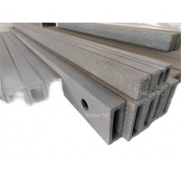
RSiC Beam Support Pill
$16.00 -
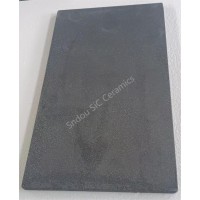
RSiC plate Slab Board
$15.00 -

NSiC Tube Pipes by Nit
Inquiry -
used excavator hudraul
$16600.00 -
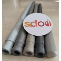
NSiC Thermocouple Prot
Inquiry -

Stalk Riser Tube for L
Inquiry -
NSiC Ceramic Heater Pr
Inquiry -

RSiC NSiC Ceramic Kiln
Inquiry -

used excavator hudraul
$11500.00
Product parameters
closure
This shop is operated by agent
- Set up shop
- Authorized by Manufacturers & Suppliers online marketplace B2B platform GongWong.com, can provide agency service
- Service Introduction
- Authorized product, Internet cloud promotion service integrating certification promotion and procurement inquiry
- Intelligent website construction
- PC terminal + mobile terminal, create a cost-effective corporate website!
closure