1/5

Geophysical Electrical Resistivity Tomography Equipment Electrical Resistivity Imaging Geoelectric
$1.00 / Piece
- FOB Price:
- Negotiable | Get Latest Price
- Order Quantity:
- 1 Set / Sets
- Supply Ability:
- 1000 Set / Sets per Month
- Port:
- shanghai
- Payment Terms:
- T/T L/C D/P D/A Credit Card PayPal Cash Escrow Other
- Delivery Detail:
- 5 days
Hot in store
-
Borehole Geophone Land Geophones Seismi
$1.00 -
Geophysical Well Logs Aquifer Mapping We
$1.00 -
Masw/Refraction/Reflection/Borehole Surv
$1.00 -
Geophone Sensors Mems Geophone Geophone
Inquiry -
Digital Incinometer Borehole Inclinomet
$1.00 -
Borehole Deviation Tester Wireless Incl
$1.00 -
Jqx-2 Best Selling Digital Inclinometer
$1.00 -
Portable Digital Inclinometer for Drilli
$1.00
Product Details
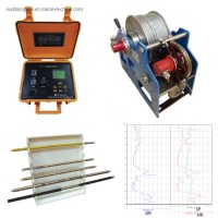
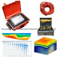
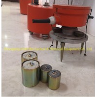
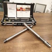
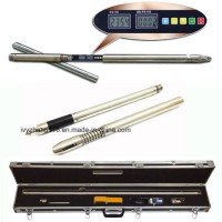
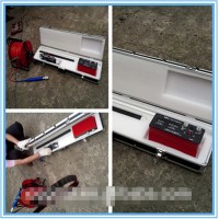
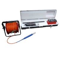
Product Name: Geophysical Electrical Resistivity Tomography Equipment, Electrical Resistivity Imaging, Geoelectric Underground Water Finder and Geological Instrument Model NO.: duk-2a electric Tomograph Usage: Electrical Resistivity Tomography Trademark: gold Transport Package: Wooden Case Specification: ISO9001 Origin: China Product Description Geophysical electrical resistivity tomography equipment, Electrical Resistivity Imaging, Geoelectric Underground Water Finder and Geological InstrumentGeo Resistivity Tomograph Survey Equipment, Electric Tomograph Electric Tomograph, Resistivity Imaging, Geoelectric Water Finder and Geological Exploration, Underground Water Exploration, Water FinderWater Detection Meter, Ground Water Detector, Resistivity Imaging, Resistivity Tomography, Ert Electrical Resistivity Tomography,Detailed Product DescriptionDUK-2A Multi-Electrode Resistivity Survey System as the survey and control unit in the systemDUK-2A Multi-Electrode Resistivity Survey SystemMain Applications1 By utilizing relevant parameters of apparent resistivity and induced polarization method, the instrument is widely used in many aspects including metal and non-metal mineral resources exploration, energy exploration, city geophysical exploration, railway and bridge engineering exploration, etc.2 Search for groundwater, solve the human and animal drinking water issue as well as industrial and agricultural water issue. Determine the hidden safety risk location in reservoir dam foundation and flood-control dyke, find faultage zone and collapse column, landslides, coal mining goaf, search for geothermal and other hydrological, engineering geological exploration.3 Accessories made by our factory with 60-channel or 120-channel multiplex electrode switch, also can be used for multi-electrode resistivity survey system.Receiving Part1 Measuring Voltage Range: -6000mV~+6000mV2 Measuring Voltage Resolution: 0.01 mV3 Measuring Voltage Accuracy: (at Vp>10mV)± 5%, ± 1 digit; (at Vp<10mV)± 1%, ± 1 digit4 Measured Apparent Polarizability Accuracy: ± 1%, ± 1 digit5 Measuring Current Range: 0~5000 mA6 Measuring Current Resolution: 0.01 mA7 Measuring Current Accuracy: (at Ip>10mA)± 5%, ± 1 digit; (at Ip<10mA)± 1%, ± Digit8 Input Impedance: ≥ 50MΩ9 Interference Suppression on 50Hz Power Frequency: Better than 80dBTransmitter Part of Geophysical Equipment1 Maximum Transmitting Power: 4500 W2 Maximum Power Supply Voltage 900V3 Maximum Power Supply Current: 5A4 Instrument has over-voltage and over-current protection devices5 Power Pulse Width: 1-60 seconds, Duty Cycle 1: 11. Resistivity Transmitter and Receier2. Electrode3. Software of EnglishGeophysical Electrical Resistivity Tomography Equipment, Electrical Resistivity Imaging, Geoelectric Underground Water Finder and Geological Instrument
Contact with Supplier
Recommend product
-
Stripped Soft Goose Fe
$3.00 -
plastic ball grinding
$30000.00 -
CAT piston pump 281
$4000.00 -

Droichead Zirconia Plu
$10.00 -

E.max crown, Veneer, I
Inquiry -
ReSiC Beams/plates/bur
$16.00 -
RSiC Slabs Boards Tile
$15.00 -
RSiC Batts as Kiln she
$15.00 -

RSiC Tube by recrystal
$10.00 -
RSiC Kiln Furniture (B
$16.00 -
RSiC Burner Nozzle Fla
$18.00 -
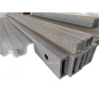
RSiC Beam Support Pill
$16.00 -
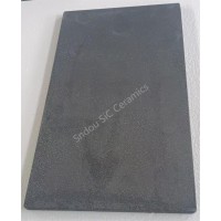
RSiC plate Slab Board
$15.00 -

NSiC Tube Pipes by Nit
Inquiry -
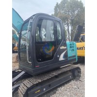
used excavator hudraul
$16600.00 -
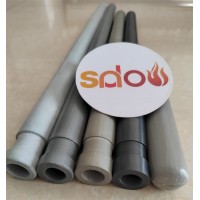
NSiC Thermocouple Prot
Inquiry -

Stalk Riser Tube for L
Inquiry -
NSiC Ceramic Heater Pr
Inquiry -

RSiC NSiC Ceramic Kiln
Inquiry -
used excavator hudraul
$11500.00
Product parameters
closure
This shop is operated by agent
- Set up shop
- Authorized by Manufacturers & Suppliers online marketplace B2B platform GongWong.com, can provide agency service
- Service Introduction
- Authorized product, Internet cloud promotion service integrating certification promotion and procurement inquiry
- Intelligent website construction
- PC terminal + mobile terminal, create a cost-effective corporate website!
closure