1/5

Geographic Geophysical Resistivity Surveying Instrument Electrical Resistivity Tomography Equipment
$1.00 / Piece
- FOB Price:
- Negotiable | Get Latest Price
- Order Quantity:
- 1 Set / Sets
- Supply Ability:
- 1000 Set / Sets per Month
- Port:
- shanghai
- Payment Terms:
- T/T L/C D/P D/A Credit Card PayPal Cash Escrow Other
- Delivery Detail:
- 5 days
Hot in store
-
Borehole Geophone Land Geophones Seismi
$1.00 -
Geophysical Well Logs Aquifer Mapping We
$1.00 -
Masw/Refraction/Reflection/Borehole Surv
$1.00 -
Geophone Sensors Mems Geophone Geophone
Inquiry -
Digital Incinometer Borehole Inclinomet
$1.00 -
Borehole Deviation Tester Wireless Incl
$1.00 -
Jqx-2 Best Selling Digital Inclinometer
$1.00 -
Portable Digital Inclinometer for Drilli
$1.00
Product Details
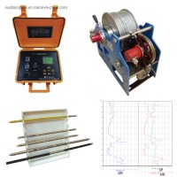
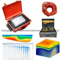
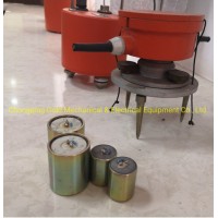
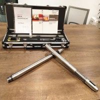
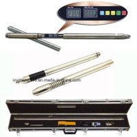
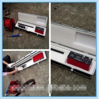
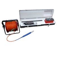
Product Name: Geographic Geophysical Resistivity Surveying Instrument Electrical Resistivity Tomography Equipment Ground Water Detector Underground Water Detection Model NO.: DUK-2A Geophysical Resistivity meter Field: Geophysical Equipment Usage: Ground Water Detector Method: Geo Tomography Method 2: Electric Tomography Method3: Resistivity Imaging Application: Groundwater Exploration Trademark: Gold Transport Package: Wooden Case Specification: ISO Origin: China HS Code: 9031809090 Product Description Geographic Surveying Instrument,Resistivity Imaging, Geo Tomography, Electric Resistivity Tomograph,Ground Water Detector, Underground Water Detection for Sale Main ApplicationsThis Geographic Surveying Instrumentcan be used in energy exploration and civil geophysical prospecting, railway and bridge survey, mental and non-mental mineral survey. It can also be used in hydro- and engineering geology survey, such as underground water, water reservoir dam site, flood control dam hidden trouble detection, and geothermic field survey.Resistivity imaging, also known as electrical resistivity tomography (ERT) is a particularly useful survey method in clayey ground, where techniques such as Ground Penetrating Radar (GPR) are less effective. The method can also help to identify transitional boundaries in subsurface layers that can be difficult to detect using other geophysical methods and is a useful tool for locating deep seated sinkholes and mine workingsMain Features.normal DC resistivity and IP measurement.2-D multi-electrode resistivity Imaging3-D multi-electrode resistivity imagingGeographic Geophysical Resistivity Surveying Instrument Electrical Resistivity Tomography Equipment Ground Water Detector Underground Water DetectionTechnical SpecificationsReceiverVoltage channel:±6VSurvey accuracy: if Vp≥10 mV then ± 5‰ ± 1 LSB, if Vp < 10 mV, then ±1% ± 1 LSBCurrent: 5ASurvey precision: if IP≥ 10mA then ± 5‰ ± 1 LSB, if IP < 10 mA, then ±1% ± 1 LSBapparent resistivity measurement accuracy: ±1% ±1 LSBdepression is more than 80dB for 50Hz industrial interference (common mode or different mode interference)input impedance: ≥50MΩTransmittermaximum supply voltage: 900V(800V for distributed multi-electrode resistivity )maximum supply current: 5AGeographic Geophysical Resistivity Surveying Instrument Electrical Resistivity Tomography Equipment Ground Water Detector Underground Water Detection Geographic Resistivity Surveying Instrument, Electrical Resistivity Tomography Equipment, Ground Water Detector, Underground Water Detection
Contact with Supplier
Recommend product
-
Stripped Soft Goose Fe
$3.00 -
plastic ball grinding
$30000.00 -
CAT piston pump 281
$4000.00 -
Droichead Zirconia Plu
$10.00 -
E.max crown, Veneer, I
Inquiry -
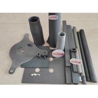
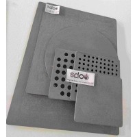
ReSiC Beams/plates/bur
$16.00 -
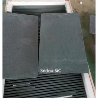
RSiC Slabs Boards Tile
$15.00 -
RSiC Batts as Kiln she
$15.00 -

RSiC Tube by recrystal
$10.00 -
RSiC Kiln Furniture (B
$16.00 -
RSiC Burner Nozzle Fla
$18.00 -
RSiC Beam Support Pill
$16.00 -
RSiC plate Slab Board
$15.00 -

NSiC Tube Pipes by Nit
Inquiry -
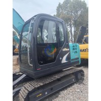
used excavator hudraul
$16600.00 -
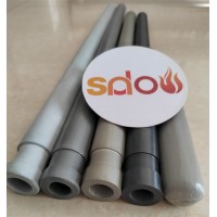
NSiC Thermocouple Prot
Inquiry -

Stalk Riser Tube for L
Inquiry -
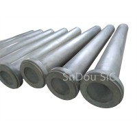
NSiC Ceramic Heater Pr
Inquiry -

RSiC NSiC Ceramic Kiln
Inquiry -
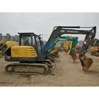
used excavator hudraul
$11500.00
Product parameters
closure
This shop is operated by agent
- Set up shop
- Authorized by Manufacturers & Suppliers online marketplace B2B platform GongWong.com, can provide agency service
- Service Introduction
- Authorized product, Internet cloud promotion service integrating certification promotion and procurement inquiry
- Intelligent website construction
- PC terminal + mobile terminal, create a cost-effective corporate website!
closure